Science education
Infographics to communicate basic concepts about Remote sensing and water.
About me
I am a Ph.D. candidate at the University of North Carolina - Chapel Hill working on fluvial hydrology and morphology. I joined the Global Hydrology Lab (GHL) in August 2022
after earning a Fulbright Scholarship.
I was born in Medellin - Colombia, the second larger city in Colombia and home
of the Universidad de Antioquia, where I got my B.S. in Sanitary Engineering and my master's in
Environmental Engineering.
Currently, I'm using Surface Water
and Ocean Topography satellite -SWOT- satellite
to derive some river properties such as rivers' cross-sectional variation (width to depth ratio) worldwide and flow depth.
Infographics to communicate basic concepts about Remote sensing and water.
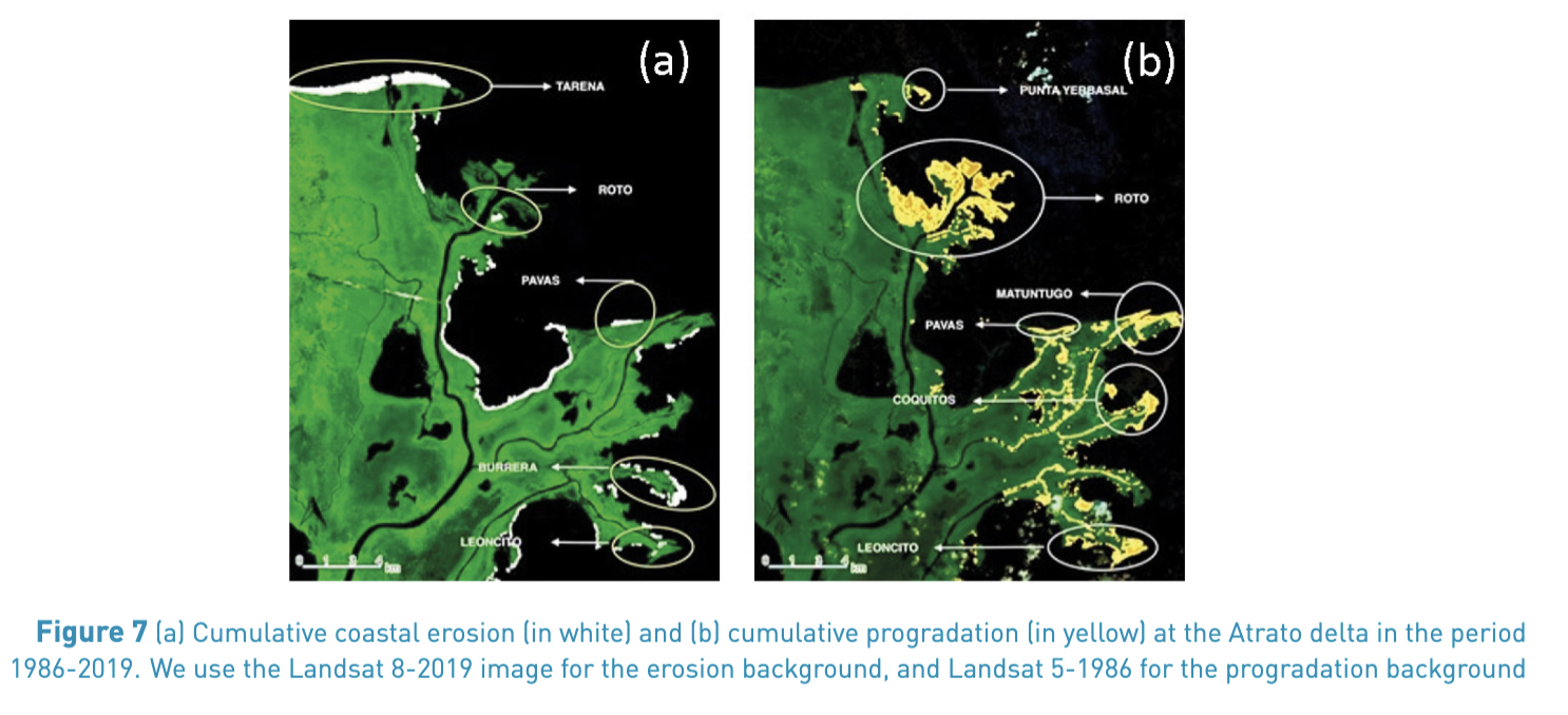
I analyzed the geomorphological changes in the shoreline of the Atrato River Delta in Northwestern Colombia, associated with erosion and progradation, using Landsat imagery, image segmentation, and Google Earth Engine (GEE) to automatically identify the changes on an annual basis over 33 years (1986–2019). Click on the title to download it.
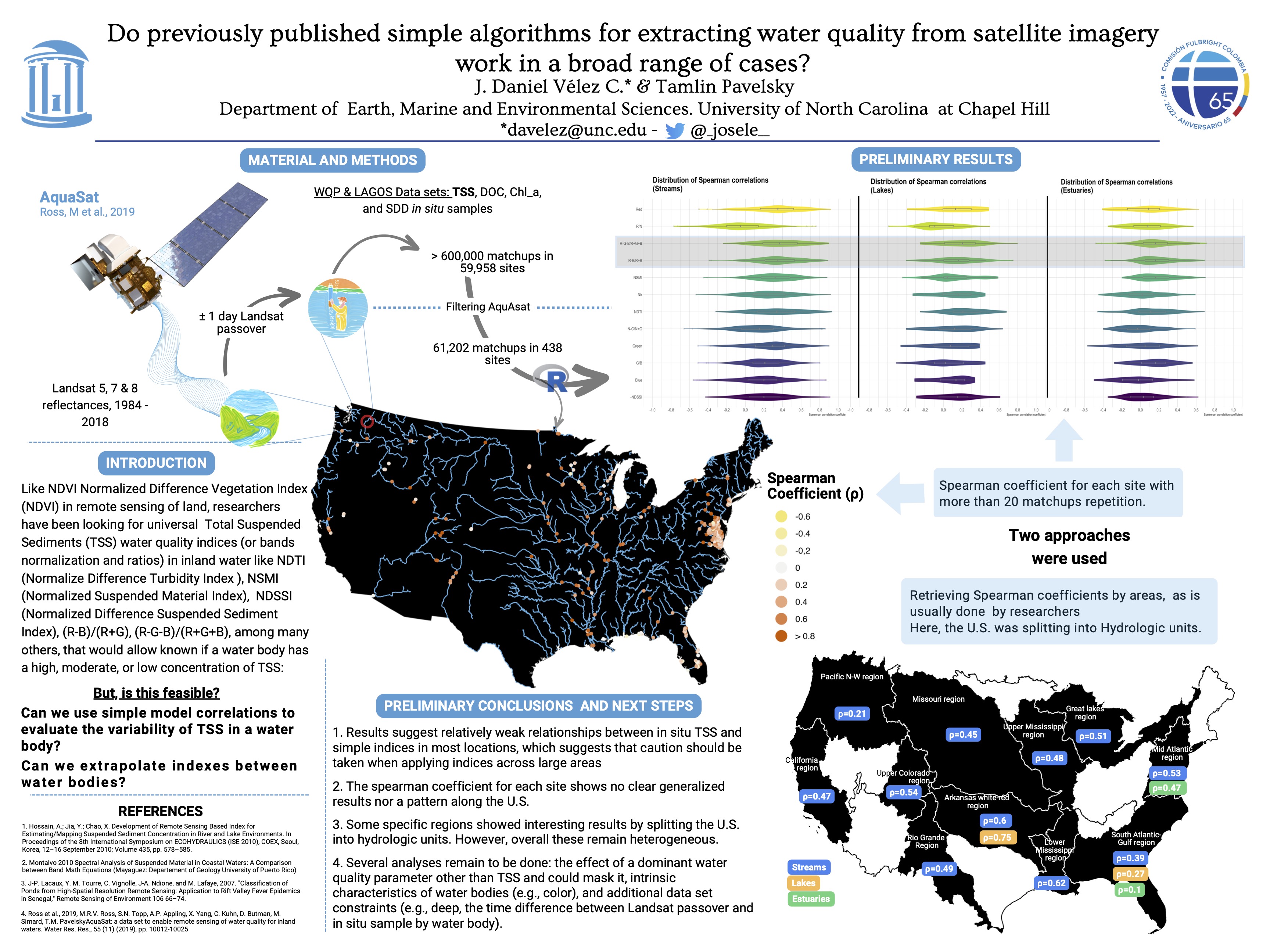
Like NDVI Normalized Difference Vegetation Index (NDVI) in remote sensing of land, researchers have been looking for universal Total Suspended Sediments (TSS) water quality indices.
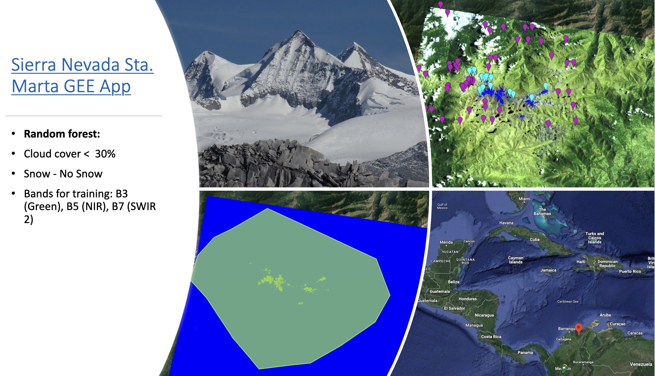
Using the Random Forest algorithm, Landsat imagery (bands: B3, B5, and B7) was classified into two classes: snow - not snow, to track the evolution of the glacier. It needs improvements (Click on the title to open it)

Lorem ipsum dolor sit amet nisl sed nullam feugiat.